 English
  |


| Quantity: | |
|---|---|
GD-C1201
Product Description
Innovative Solutions for Subsurface Characterization
Introducing a new era in borehole investigation technology, the GD-C1201 Intelligent Drillhole Optical Imager combines pioneering optical innovation with sophisticated digital processing to deliver transformative capabilities in subsurface characterization. This system represents the culmination of extensive research and development in geological imaging technology, offering unprecedented insights into subsurface conditions.

Groundbreaking Technological Features
Advanced Imaging Technology:
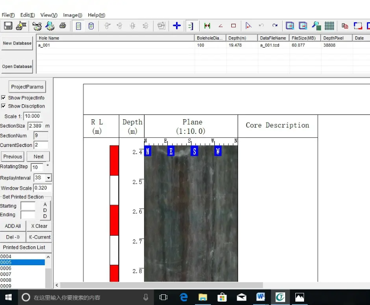
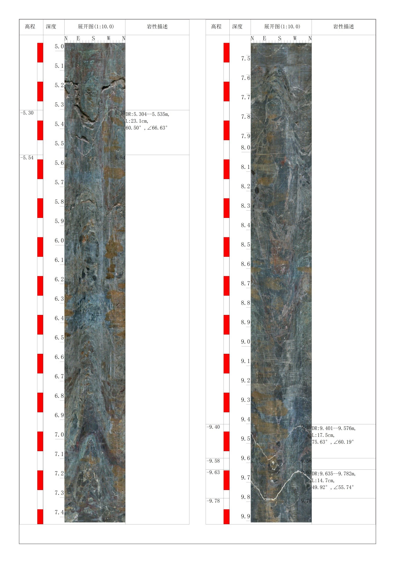
The system's revolutionary imaging platform incorporates a high-performance 1.34-megapixel CMOS sensor with proprietary noise reduction technology to achieve exceptional image clarity in challenging subsurface environments. The intelligent lighting system features multi-zone LED arrays with automatic intensity adjustment to optimize illumination across varying geological materials and surface textures. The advanced optical design ensures consistent focus and minimal distortion throughout the entire field of view.
Sophisticated Data Integration:
Leveraging state-of-the-art processing architecture, the system performs real-time image enhancement, automatic feature recognition, and intelligent data compression. The integrated depth synchronization system maintains precise positional accuracy while the advanced orientation sensors provide comprehensive spatial data for three-dimensional modeling. The system's intelligent memory management ensures optimal storage utilization while preserving maximum image quality.
Exceptional Durability Design:
Constructed with aerospace-grade materials and military-specification components, the system delivers outstanding reliability in the most demanding operating conditions. The hermetically sealed pressure housings protect sensitive electronics from moisture, corrosion, and physical impact, while the specialized cable design incorporates armored reinforcement for extended service life in abrasive conditions.
Comprehensive Analytics Platform:
The innovative software suite provides powerful tools for data visualization, quantitative analysis, and professional reporting. The system's machine learning algorithms continuously improve feature recognition accuracy through pattern analysis, while the cloud connectivity features enable seamless data sharing and collaborative interpretation across distributed teams.

Detailed Technical Specifications
| System Attribute | Performance Metrics |
|---|---|
| Imaging Performance | 1.34MP high-dynamic-range sensor, 700-line resolution, 0.1mm detail detection, 0.1 Lux minimum illumination |
| Processing Capability | Dual-core processing unit, 16GB high-speed storage, hardware-accelerated algorithms, real-time data streaming |
| Physical Characteristics | 255×192×74mm host dimensions, 1.8kg system weight, Φ24-65mm probe options, 15MPa pressure rating |
| Power System | High-efficiency battery system, 8-hour operational endurance, rapid charging capability, multiple power input options |
| Measurement Systems | 0.1mm depth measurement resolution, 0.1° orientation accuracy, 1500m maximum operational depth |

Comprehensive Application Portfolio
Resource Exploration: Detailed documentation of ore body characteristics, structural controls, and mineralogical associations for resource definition and mine planning. The system's high-resolution imaging reveals textural relationships and mineralization patterns critical for geological interpretation and resource modeling, while the quantitative measurement tools provide essential data for resource estimation and mine design.
Geotechnical Investigation: Comprehensive assessment of rock mass conditions for engineering design and construction monitoring. The technology enables detailed characterization of discontinuities, weathering profiles, and material variations essential for slope design, foundation analysis, and underground construction, providing data quality that often surpasses traditional core logging.
Environmental Investigation: Precise mapping of subsurface stratigraphy and contaminant distribution for environmental assessment and remediation design. The system identifies preferential flow paths, containment structures, and migration barriers with unprecedented clarity, supporting effective environmental management and regulatory compliance.
Infrastructure Development: Thorough inspection of geological conditions for linear infrastructure, urban development, and energy projects. The non-destructive investigation capability provides valuable data for route selection, design optimization, and risk mitigation across diverse project types and geological settings.

Strategic Implementation Benefits
The system's modular architecture supports flexible deployment across varied investigation scenarios, while the intuitive operational interface ensures rapid proficiency development for field personnel. The comprehensive data management system facilitates efficient workflow integration and quality-assured deliverables, significantly enhancing project efficiency and data reliability.
Backed by international certifications and robust technical support, the GD-C1201 establishes new standards of excellence in subsurface investigation, providing unparalleled capabilities for professionals committed to data-driven decision making and project excellence in geological characterization.
